
Ukraine may begin scanning forests using LIDAR technology. The State Forestry Agency is currently awaiting the procurement of the relevant service and the search for an experienced contractor. If all goes well, remote sensing of forests will begin next year.
This was announced by Viktor Smal, head of the State Forestry Agency of Ukraine, in an interview with Interfax-Ukraine.
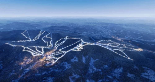
The technology involves the use of unmanned aerial vehicles with LIDAR equipment. It allows you to create a 3D projection of the forest and determine the volume of timber in a specific area. The key point is that this data simplifies timber accounting and eliminates the human factor, such as manipulation or simple oversight.
Hidden timber reserves
European experience shows that the introduction of this technology usually reveals greater timber reserves than previously thought. In EU member states, the average increase is at least 5%.
"In the case of Ukraine, we can safely say that there is a 10% increase. If we have 15 million cubic meters of annual harvest, that's an additional 1.5 million cubic meters. And even if we multiply that by a modest price of €50, that's €75 million," said Viktor Smal.
The introduction of LIDAR scanning for the forestry agency is the first step towards creating a digital mechanism for tracking timber stocks. It is best to scan forests every 3-4 years. This will allow us to create and analyze a model of the "life" of a forest area – its productivity and the impact of management methods on it.
Cooperation with the military
Scanning forest areas provides much more information than just timber reserves. According to the head of the State Forestry Agency, LIDAR technology allows the creation of three-dimensional maps of the landscape, which in the future could help in various fields, from road construction to defense. That is why LIDAR surveying in the EU is often carried out in cooperation with the military.
In Ukraine, however, due to hostilities over vast territories, it is dangerous to fly "forest" probes, and in other areas, permission from law enforcement or security agencies is required. Therefore, according to Viktor Smal, they are currently planning to scan forests in the west of the country. To this end, a memorandum has been signed with the Ministry of Internal Affairs.
EcoPolitic previously reported that Ukraine has banned the export of unprocessed timber until the end of the year.